Measurement of points |


|
|
If the source and the output coordinate system is virtually identical, the measurements are more convenient to perform in one window. In this case, to the transformed map before starting the task must be added a map or a raster for measurement of points in the output coordinate system. If an input and output system of coordinates considerably differ, measurement of points is carried out in a two-window mode. In the main window which was active during the moment of starting the task, the transformed map should be opened. Points in output system of coordinates are measured on a vector or raster map in the additional window. The additional window is selected from the list «Output coordinates are measured on a map». The list of additional maps is filled at start of the task and automatically is updated at opening and closing additional maps. After start of the task to open an additional map it is possible as by standard means of the GIS Panorama, as well as by pressing the button In a two-window mode the measurement of points is carried out by pressing the left button of the mouse on the main and additional map in the any order. In one-window mode at first it is necessary to measure a point in initial system of coordinates, then in output. The measured point is shown on maps by circles with number of a point and in the table of the measured points. In an one-window mode the one-name points are connected by a line. Color of displaying a point on a map may be changed on the bookmark «Advanced». To select a point it is possible having chosen a point in the table by number, or to put the cursor at the necessary point, and to press a spacebar. The marked point will move to the center of a window. After measurement of one point an automatic synchronization of maps is carried out, i.e. at moving on one window the map in other window is displaced. You can disable synchronization on the bookmark «Advanced». Saving the measured points into catalogs of coordinates is done automatically when you close the task or when you click the button
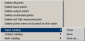
The points that are downloaded from the catalogs of coordinates may be measured in addition or remeasured on the map. If one catalogue of coordinates is downloaded only, to measure points in another coordinate system it is possible by using of the «Remeasure» with the enabled mode for the convenience «The transition to the next point after a remeasurement». At each measurement the parameters of transformation automatically are recalculated. If parameters of transformation were not calculated, residual divergences and a mean-square deviation will not be displayed. You can learn the reason of error when you click "Transform" button. Thus the message describing the error will be given. More often the reason of an error is the insufficient number of the measured points for the chosen method of transformation. By the calculated parameters of transformation the residual divergences and a mean-square deviation are calculated. The mean-square deviation is calculated separately for ground control points (GCP) and check points (ground control points are used for calculation of parameters of transformation, but check points are not used). If the point number in the box has been ticked, then the point is considered the ground control point, if not - the check point. For the analysis of divergences it is possible to sort the table by columns by clicking on heading of appropriate column of the table. Residual divergences are calculated in input system of coordinates. If scale of input system of coordinates is incorrect (it happens when at loading a raster the wrong resolution or scale have been entered), to obtain the true value in meters the calculated divergences are multiplied by the scale factor, calculated by control points. The table displays discrepancies shown to meters on the ground. Real divergences between the measured and calculated coordinates of points in input system of coordinates are displayed in the protocol, which can be viewed by clicking on the button If you select one of the linear method of transformation, the protocol contains factors of calculation, which can be used in third-party software. If many points are measured, slow-down of work of the program is possible at calculating parameters of transformation by type of linear, nonlinear rubber sheet. In this case, the points should be measured in the mode of an affine transformation, and after measuring all the points to change the type of transformation onto the rubber sheet. In the task three operating modes are accessible: 1. Measure 2. Remeasure In the one-window mode a remeasurement of the current point in the input coordinate system is made by pressing the left mouse button, and an output coupled with the key Ctrl. In two-window mode points are remeasured at pressing the left mouse button in the main or secondary window. 3. Delete The point is not obligatory for deleting from the list. To exclude it from the list of points used for calculating the elements of orientation you can having removed a tick in number of a point. At measurement and remeasurement the mode «Snap to point» If to include «The transition to the next point after a remeasurement» |