Settings |


|
|
Settings task is called in the "Map processing by scenario" dialog when you click the Settings button.
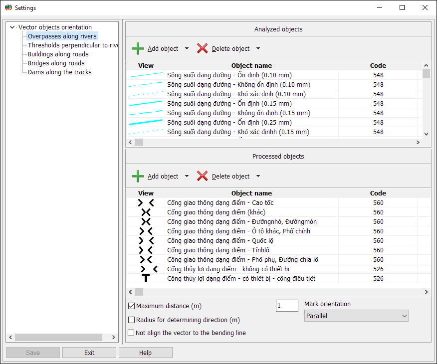
This dialog is used for customizing parameters of the following tasks: - Vector objects orientation; - Vector objects offset.
Task parameters: - Analyzed objects - the list of objects, which contour are used as reference points for clarifying the direction and position of vector marks. - Processed objects - the list of objects that will change during the execution of the task. - Maximum distance - the maximum distance between the analyzed and processed objects, at which the object will be processed. The value is indicated in meters on the terrain. - Radius for determining direction - radius for determining the direction is used for orientation of vector marks. This parameter is taken into account only for those objects that have the Predefined digitizing direction in the map classifier. The value is indicated in meters on the terrain. - Not align the vector to the bending line - this mode is used to turn off the alignment of vector marks on the turns of the contours of the analyzed objects. Thus, the turn angle is specified in degrees. Turning off the alignment is applied to buildings that are aligned concerning contours of roads. - Mark orientation - this parameter determines the mode of orientation of the vector mark relative to the analyzed contours.
Orientation modes: - Parallel - the mark is oriented along the analyzed object in the direction of digitizing. - Perpendicularly - the mark is oriented perpendicularly to the analyzed object.
Forming lists Analyzed objects and Processed objects is performed using the following modes:
Dialogue view:
After completing the customization of parametres it is necessary to press the Save button. |