Import of data list from SXF format |


|
|
Format SXF is the format of the exchange and storage of vector maps in the archive. The format was developed in 1992 by specialists of Topographical Service of the Armed Forces of the Russian Federation and in 1993 was approved as a primary exchange format of the digital information about the area in Armed forces and a number of Federal Services of the Russian Federation.
Format SXF provides a more effective solution of the following tasks: - archiving of digital topographic and navigation maps and plans of cities; - increasing the reliability of storage and reliability of transferring digital maps on various media and by communication channels; - decrease of sizes for the stored information; - use of various technologies and means for creating digital topographical and navigation charts and plans of cities, with result reduction to a common format.
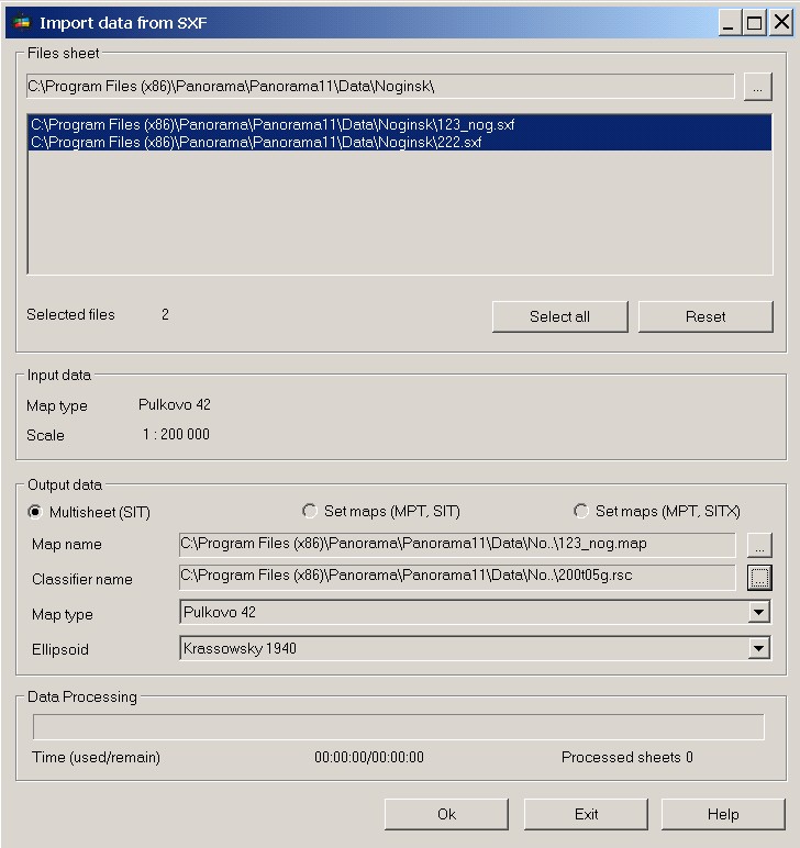
In the presence of considerable number of maps of format SXF and necessity of their loading into a multisheet map with possible change of a projection there is the task of Import of data from SXF format.
At starting the task it is necessary to choose the necessary number of SXF maps in the dialog window of opening a file. For an ensuring of loading the list of data with projection change it is necessary to set the appropriate type of map and ellipsoid. If the coverage area of the source data is more than three zones, it is expedient to choose map's type the Cylindrical Mercator on the ellipsoid the Sphere on WGS-84. Result of the program's execution is the map MPT which contains sheets depending on the specified types in the dialog window - MAP, SIT, SITX. |