Forming a rule of nomenclature sheets of local coordinate system |


|
|
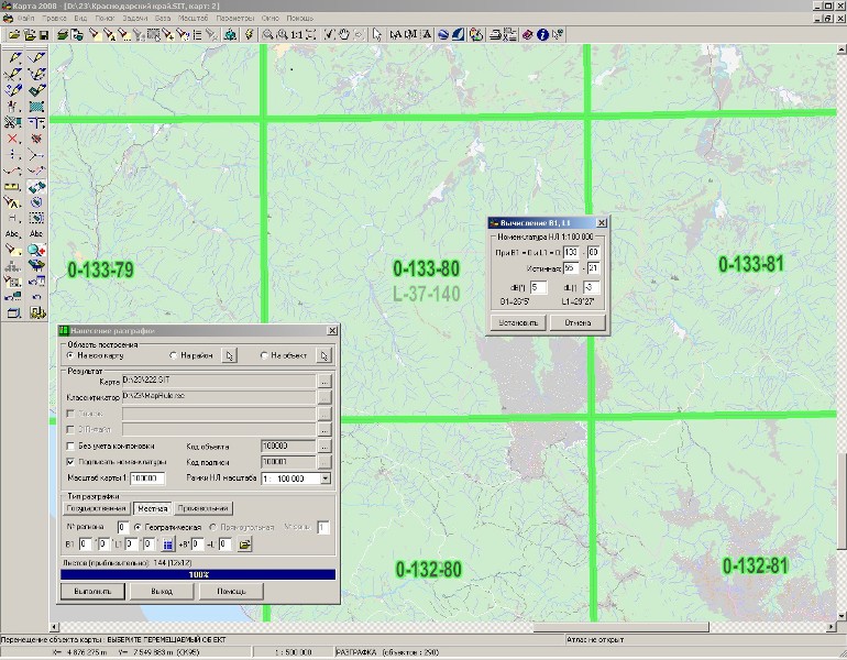
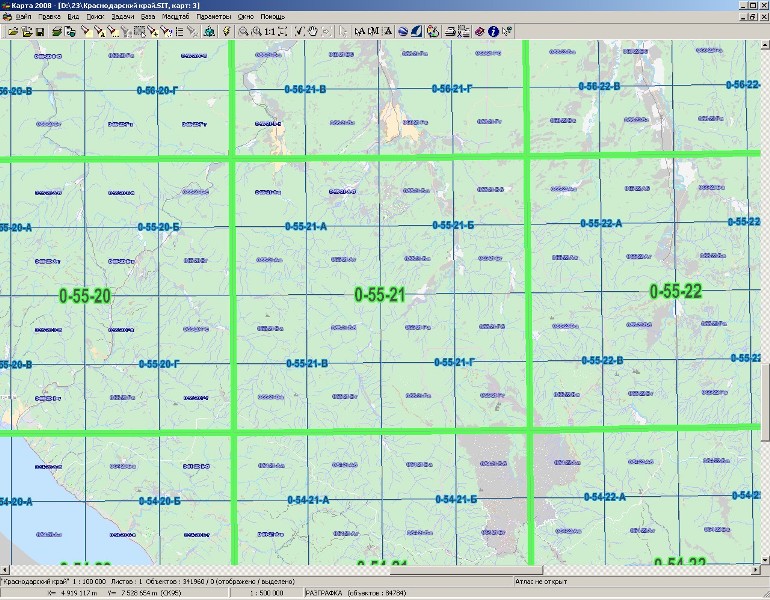
Formation of rule and nomenclature of sheets prepared in the Gauss projection with a local coordinate grid, is made in accordance with the «General regulations for the use of local coordinate systems when performing works on the state land cadastre, monitoring of lands and land management». Making a rule of the nomenclature sheets relevant to a given local coordinate system, is made on the background of a current open map, in its coordinate system. For transformation of the formed map of a rule directly into the specified local coordinate system it is necessary to execute the appropriate procedure. For maps of scales 1:100 000, 1:50 000, 1:25 000, 1:10 000 the geodetic rule (division) is applied. Rectangular and geodetic divisions are applied to plans of scales 1:5 000 and 1:2 000. Plans of scales 1:1 000 are made in a rectangular division. The geodetic rule can be constructed only on the background of a map supporting recalculation into geodetic coordinates. For making a sheet division by geodetic dimensions B (latitude) and L (longitude), it is necessary to specify the coordinates of the lower left (South-West) and upper right corners (Northeast) of the created area in degrees and minutes. The initial data for construction of a geodetic rule and formation of sheets nomenclatures of local coordinate system are: - geodetic coordinates of an origin of nomenclature sheets of scale 1:100 000 (B1, L1) or pair of nomenclatures of the respective sheets in the projection of Gauss-Kruger and the Gauss projection with a local coordinate grid; - coordinates offset of borders of nomenclature sheets of local system on latitude (+-B) and on longitude (+ - L) concerning a corresponding border of nomenclature shee (NS)t in the projection of Gauss-Kruger. In case at the moment of commencement of works the geodetic coordinates of an origin are known, they together with values of offsets are entered directly into the appropriate fields of the dialog window. In a case at the moment of commencement of works there are not known geodetic coordinates of the origin (B1, L1), their definition is carried out in the following sequence: 1. Process of making a rule is activated, constructing a rule of nomenclature sheet of scale 1:100 000 in a projection of Gauss-Kruger is carried out (bookmark - "Standard"), the task of creating a rule is finished. 2. On the created map a search of the nomenclature sheet defined for specifying of conformity is carried out. It is recommended to to shift by means of Map Editor the title of the nomenclature a bit up or down, brightness of the constructed map is recommended to be increased. 3. Process of making a rule is activated, construction of rule of nomenclature sheet of scale 1:100 000 for local coordinate system is carried out. It is not necessary to specify as a map - result the earlier constructed map. All parameters (B1, L1, +-B, +-L) should be equal to 0. 4. Without closing the dialog task a search of the appropriate pair of nomenclature sheet is carried out. Due to the fact that the nomenclature title was previously moved, it was not closed by again created nomenclature, and the brightness difference allows to distinguish two constructed maps of rule.
5. In the dialog window it is necessary to press the button «Calculate origin» and to enter the necessary information. Actually received nomenclature at zero initial values (a number of row and column) and the true nomenclature (which should correspond to the chosen nomenclature sheet in the projection of Gauss-Kruger), and also values of offsets of latitude and longitude. To press button «Set». Dialogue of calculations will be closed, the calculated values automatically will be transferred into the appropriate fields.
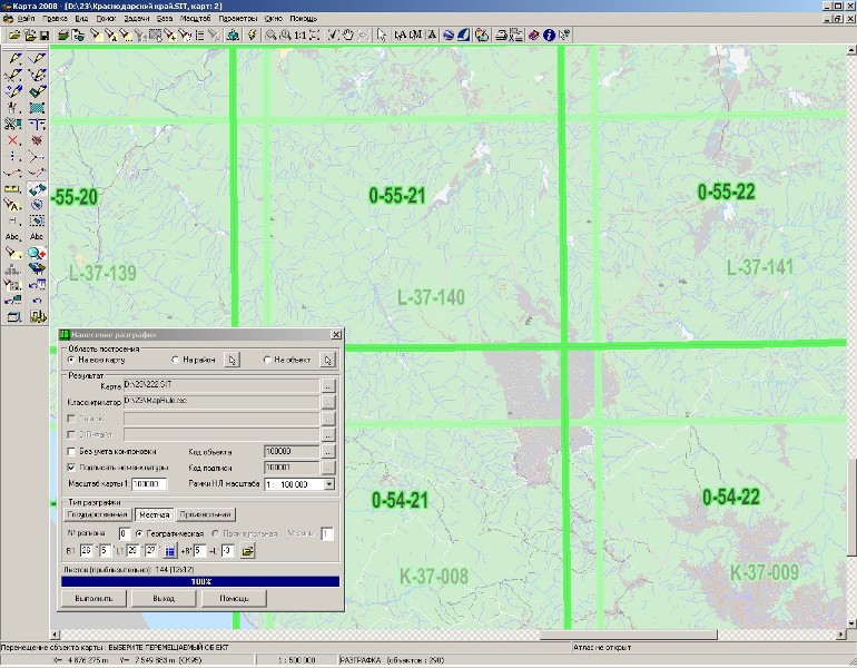
6. Repeatedly to press button «Ok». Onto the question «Add a map» to answer «No» (full replacement) will be executed. 7. To check up conformity of nomenclatures. Discrepancy means that the data in dialog of calculation of the origin has been entered incorrectly. In this case it is necessary to null the initial data and to repeat process starting from item 3.
When the task is completed, the calculated data is automatically saved in the .INI file. Therefore at the subsequent construction of a rule onto region for which the earlier calculations were performed, it is enough to enter number of region and to press the button «Load values». |