Import of data from TLS/OC3 formats to DB3D format |


|
|
The program is intended for importing data of 3D models from TLS/OC3/DAE formats to DB3D format. The TLS format is a binary file that stores the coordinates of textured 3D models with support for detail levels, the models have a tile structure. TLS format was developed by Agisoft company and implemented in the Agisoft Photoscan product. With TLS format, the Sputnik software of the GeoScan group of companies operates. OC3 format is a binary file which stores the coordinates and color for points, which are combined into tiles distributed by detail levels. The OC3 format was developed by Agisoft company and implemented in the software product Agisoft Photoscan. DAE (COLLADA) format stores a 3D model, the parameters of which are described in the xml file. If the model has textures, they are stored in graphic files, which are usually located in a separate directory. Format DB3D is a file of database SQLite 3.0 and above, where in the form of tables the description of 3D models on the terrain is stored. Viewing models together with a map is possible in the task "Navigator 3D", the degree of models details depends on the scale of the display.
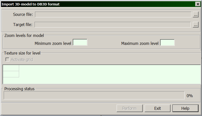
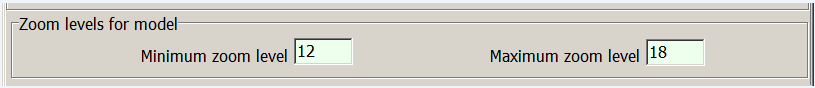
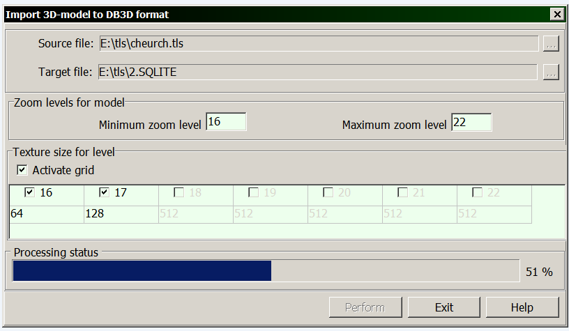
For starting the program of import it is necessary to perform the following actions: 1) to select the location and specify the source file TLS, OC3 or DAE; 2) to select the location and specify the target file SQLITE, if it already exists, or to specify the name of the new SQLITE, then it will be created; 3) to set the minimum and maximum scale levels of the model:
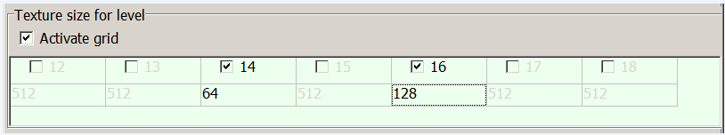
4) in case the source file is in TLS format, it is possible to specify the size of textures for each level of detail; for this, in the dialog box, select the item «Activate grid»; in the first line of the table, to select the levels numbers for which it is necessary to change the size of textures, in the second line to set the desired size (values of the textures sizes cannot exceed the original one and must be a power of number of two):
where in the corresponding cells you can specify the coordinates of point of beginning the model.
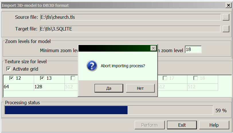
5) to click on the «Perform» button, which will become active if the source and target files are correctly specified. The duration of the importing process depends on the number of unloaded zoom levels, the number and size of textures, the geographical area of the model and can take tens of minutes.
You can abort the process of importing data by clicking the «Exit» button directly during the performing.
User positioning of 3D-model When importing a model from the DAE format, it is possible to change its location and sizes on the map, for this you need to agree in the dialog that appears after the import process is completed:
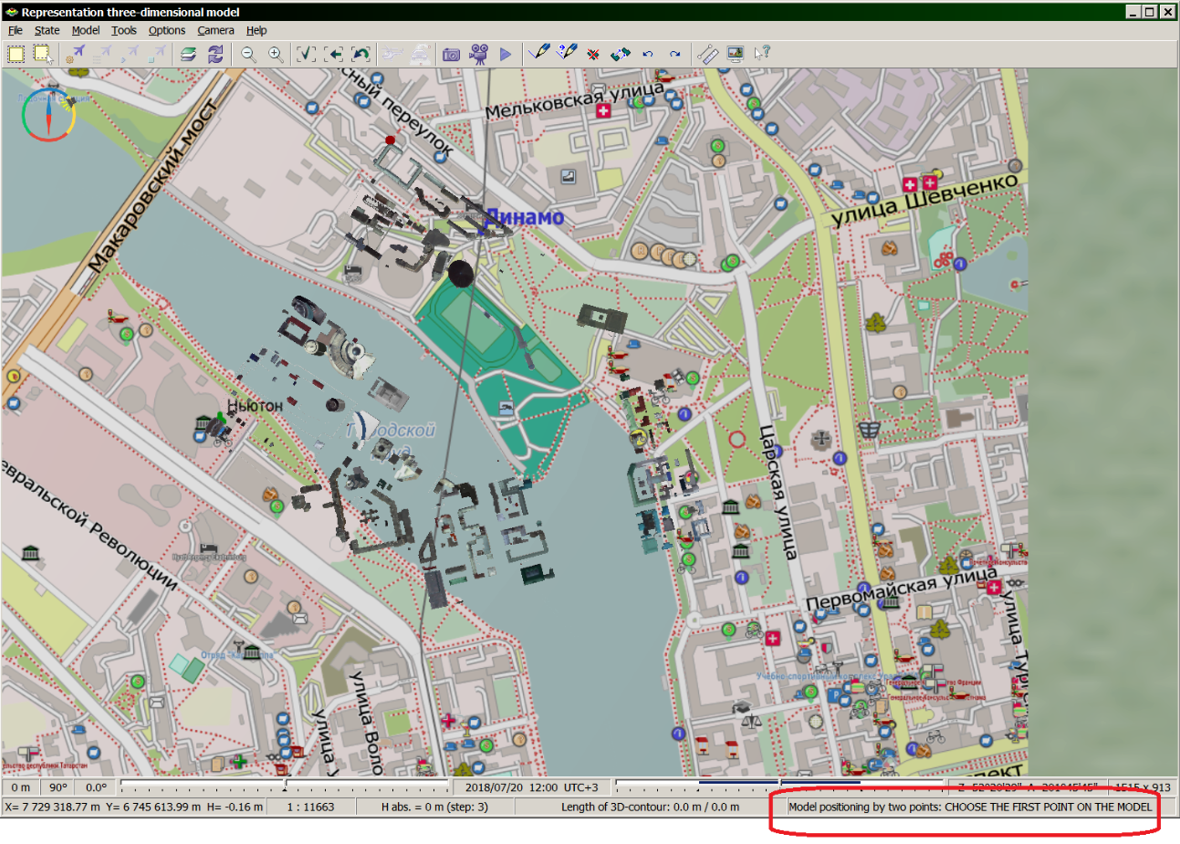
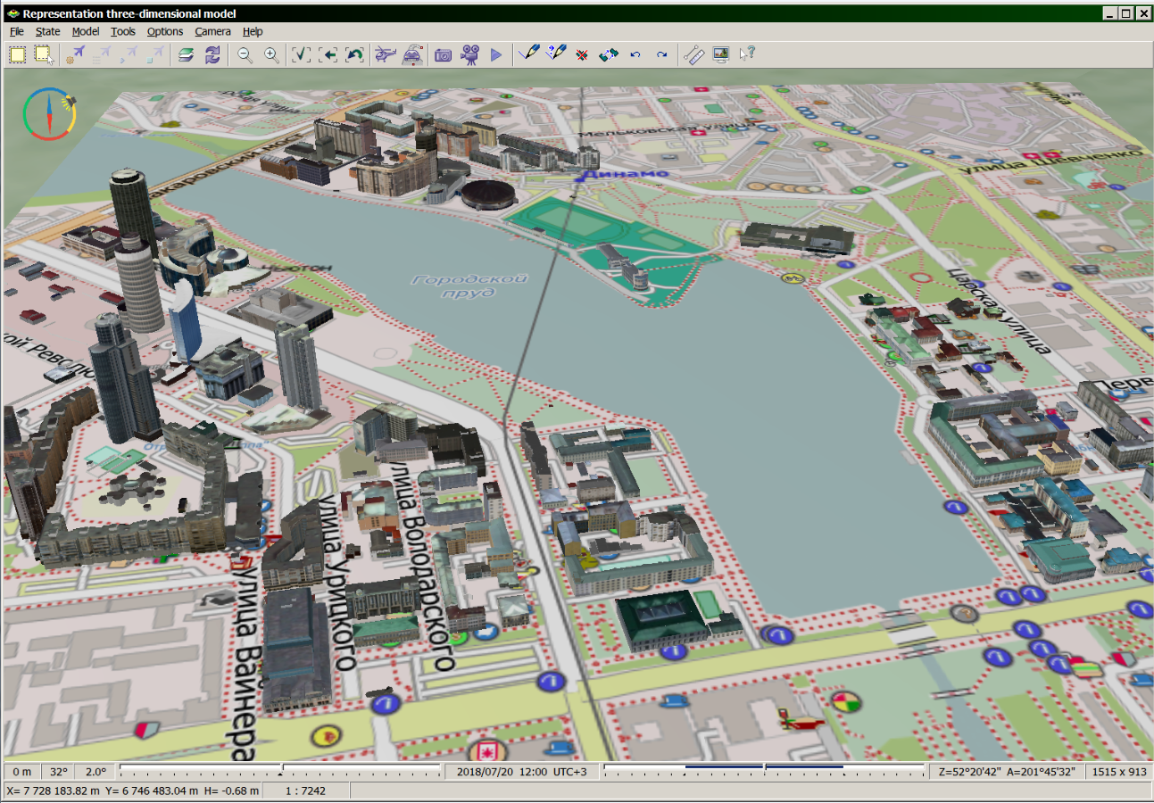
Then follow the instructions from the status bar of the main window «Representation three-dimensional model»:
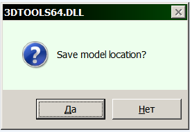
1) Use the left mouse button to select the first point on the model. Point height can be regulated by keys PageUp/PageDown, value of height is displayed also in the status bar in the parameter Nabs. You can deselect the last point by pressing the Esc key. 2) Specify a point on the 3D map corresponding to the first selected point of the model. 3) Select the second point on the model. 4) Specify a point on the 3D map corresponding to the second selected point of the model. 5) To complete the selection of four points, hold down the Ctrl key and click the left mouse button. 6) Upon completion of the process of importing the model into a new position, the following dialog will be displayed:
By clicking «No», the model with the original coordinates will remain in the resulting file, by clicking «Yes», the 3D-model with the new coordinates will be written into the resulting SQLITE file:
|