Process of implementation for import of layers of DTM from the geo database ArcSDE Oracle |


|
|
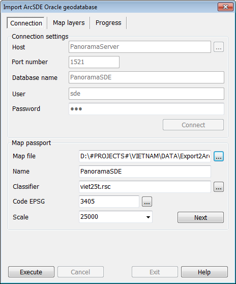
To export the layers of DTM to the geo database ArcSDE Oracle, it is necessary in GIS Panorama to select the item from the menu «File – Import from... – ArcSDE Oracle geodatabase». The dialog «Import ArcSDE Oracle geodatabase» should start. In the dialog «Import ArcSDE Oracle geodatabase», it is necessary to fill the connection parameters with the server of database Oracle and to execute connection. The connection must be established on behalf of the user SDE (or another user with the same authority in the geo database).
After the successful connection, the default values in the parameters for creating DTM to place the imported data will be filled. If it is necessary, these parameters can be changed. To create DTM, all parameters must be specified: - name of the map file; - classifier; - name of the map; - EPSG code; - basic scale.
Executing a connection to the geo database ArcSDE
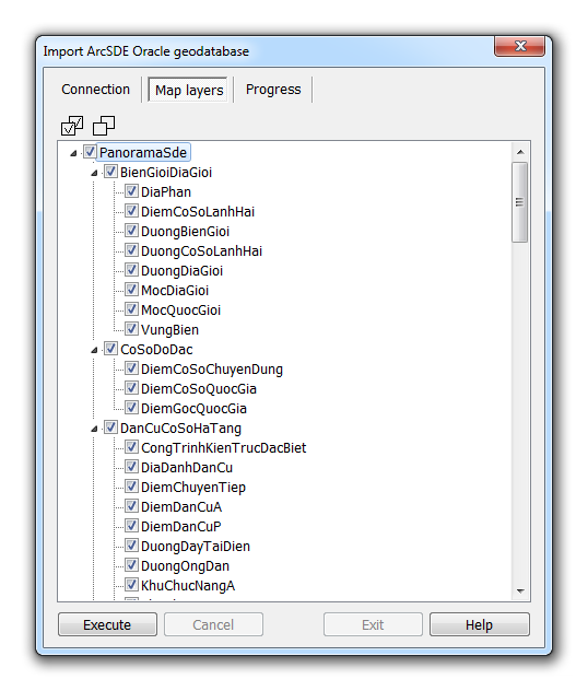
If you successfully connect to the database Oracle, the tab «Layers of DTM» will display a list of tables registered in the geo database ArcSDE Oracle, which are used to store spatial data on the layers of DTM. If it is necessary, on this tab, you can select individual tables from which data will be downloaded to DTM. In this way, the composition of DTM layers is selected for import from the geo database ArcSDE Oracle. By default, all tables are selected.
Selecting the composition of DTM layers imported from the geo database ArcSDE Oracle
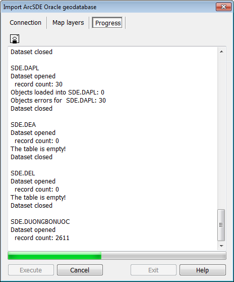
If the connection to the database is successful, all necessary parameters for creating the map-result are filled, the button «Run» becomes available. When you click on it, the process of importing selected layers of DTM from the geo database ArcSDE Oracle starts. Unlisted tables do not participate in the data import process.
The procedure for importing layers of DTM during the execution
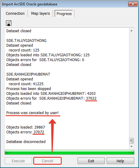
During the import, a protocol is kept in which messages about the execution process are recorded. Errors are also output to this protocol. The protocol can be saved to a text file on the disk using the button You can interrupt the import of DTM layers into the geo database ArcSDE. To do this, click the button «Cancel». The execution process will be aborted, all the under-processed objects in the current table will be considered incorrect, the following tables will not be processed. In the event of a process interruption in the window GIS Panorama, the map will be opened in the volume of objects that was loaded at the time of the command to interrupt the process. Such map can not be considered a correct import result, and the import procedure must be repeated. In order to be able to re-import DTM map with the same file name, this map should be closed.
Interrupting the import process during the execution
When data is loaded, a map with imported data from the geo database ArcSDE Oracle will be opened in the window GIS Panorama. The resulting map can be subjected to post-processing procedures.
|