Additional options |


|
|
If necessary you can add to the main map the additional user maps (files with extension SIT), files of projects MPT, rasters, matrixes. Addition of additional user maps is carried out at a choice of the menu File - Add map or View - Map composition. Up to rasterization of a vector map there is an opportunity of presetting display of map objects for each scale, for example in the editor of the classifier or the program of the GIS the Map 2008. Presetting data makes a raster map more evident and convenient for perception.
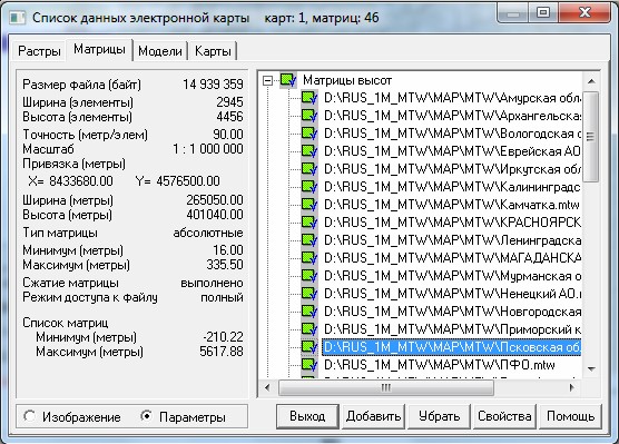
Dialog of customizing list of data:
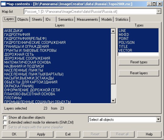
There is an opportunity of displaying shadows by matrixes of heights for pseudo-volumetric graphics (for mountain area). View - Map composition - Matrix bookmark - Properties button - Matrix image - Only shadows. At formation of tiles the functions of anti-aliasing for linear objects are used. For improvement of displaying vector data a printer mode exists, View - Map View - Printer view. If you want to disable some layers or types of objects a customizing the maps contents (the main and additional) can be executed. Customizing maps contents is carried out at a choice of the menu View - Map contents.
Dialog of customizing map contents:
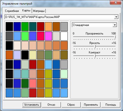
Language of the interface (Russian, English) can be changed in the View menu. The chosen language of the interface is saved in a file ImageryCreator.INI. At restart of the program the language of the interface is restored. At a choice of the menu Help - Information the Reference form is opened containing the description of application's work. For specifying the size of output rasters PNG, JPEG, it is necessary to change value in a field "element size". By default it is equal to 256 pixels. For change of a map palette, it is necessary to set the colors used on a map: View - Palette.
Dialog of customizing color gamut:
View map button serves to enable/disable a mode of viewing a map. For specifying extension of created files use the option Options - File format. To set a transparency of tiles use the option View - Background. |