Construction of engineering-geological columns |


|
|
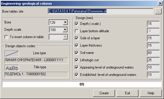
It is possible to generate the drawing for one borehole or to place onto one user map some engineering-geological columns. In dialog of a mode it is necessary to specify parameters of the drawing construction: - to set a map name of the drawing of an engineering-geological column; - to enter a scale of depths (scale on a vertical axis of the drawing); - to specify codes of design objects; - to enter structure and placing of objects of designing.
Upon termination of creation open a map containing the drawing of an engineering-geological column, by standard means of the GIS Panorama. Order of an execution of the task: - to mark on a map the point objects - boreholes for which it is necessary to construct the drawing of an engineering-geological column; - to choose a mode «Creating engineering-geological columns»; - to specify parameters of the drawing formation; - to open a map containing the drawing of engineering-geological columns; - if necessary to make changes on the drawing by means of the map editor.
|