|
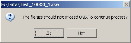
Question: Why at attempt of loading the file Test_10000_1.tif into a raster map the program asks the question: «The file size calculated for the formed raster map, is 11,439 GB. The The file size should not exceed 8GB (two files in 4GB, the name of an additional file is formed by addition to the filename of a raster map ".01"). All saved area will not be located in a file of a raster map. To continue process?».
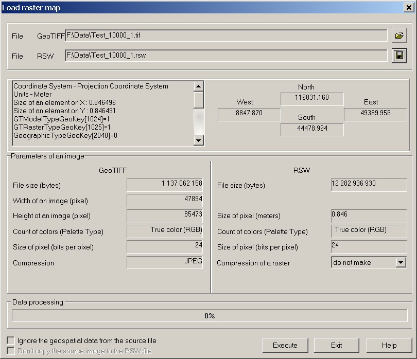
What to do in this case? Answer: The image in file Test_10000_1.tif is compressed by JPEG method. The raster map is created with color depth of 24 bits per pixel. The size of the created file is calculated by the program and makes 12 282 936 930 byte, or 11,439 GB.
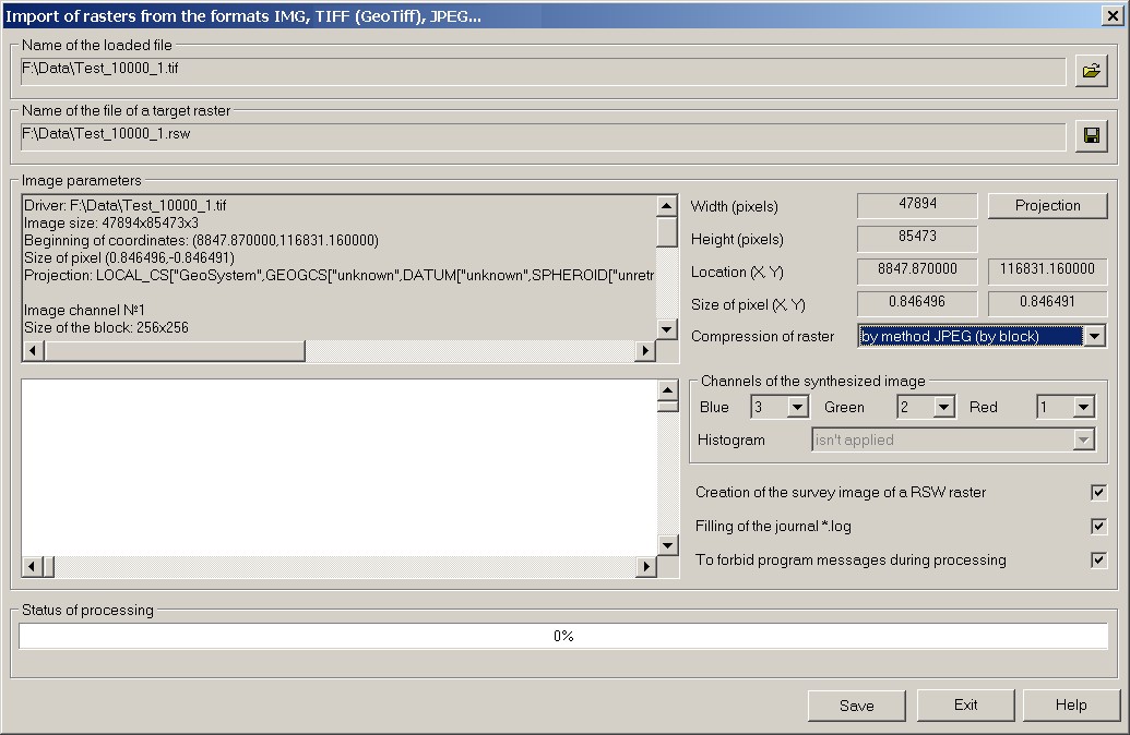
The maximum size of a raster map is 8GB - two files by 4GB. In this case for correct loading the image of the Test_10000_1.tif file into raster map RSW in dialog «Import of rasters from the formats IMG, Tiff (GeoTiff), JPEG …» specify in the drop-down list «Compression of raster RSW» the method «by method JPEG (by block)».
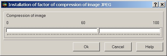
Further carry out converting. The program also will suggest to specify the value of coefficient of compression of a raster's image by algorithm JPEG. Recommended value of compression coefficient - 60.
Into the formed raster RSW the image compressed by method JPEG will be written. The size of received file RSW has made 495 299 193 byte, or 472,354 MB. |