|
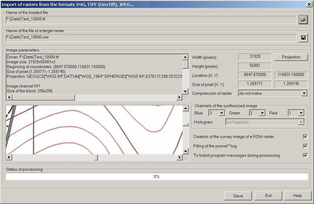
Question: Why after loading file Test_10000.tif into a raster map the raster image «has not sat down on its place»?
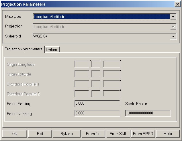
Answer: In Test_10000.tif file there are specified parameters of projection and the coordinate system corresponding to the type of a map "Latitude/Longitude" (Lat/Lon) on the spheroid WGS84, and a placing the image and the sizes of a raster's element in meters in local coordinate system (see figure 1 and figure 2). This combination contradicts the description of GeoTiff format.
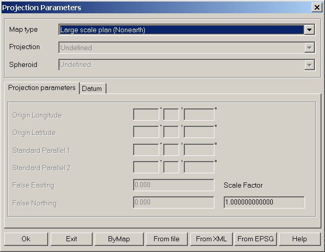
In this case for correct loading the image of the Test_10000.tif file into raster map RSW in the dialog «Projection Parameters» which is called by button "Projection" of dialog «Import of rasters from the formats IMG, Tiff (GeoTiff), JPEG …», specify the map type «Large-scale plan».
Further carry out converting. Parameters of a projection and coordinate system will not placed into file RSW. In formed raster RSW there will be written the image binding in meters on the ground, corresponding to your local system of coordinates. |